
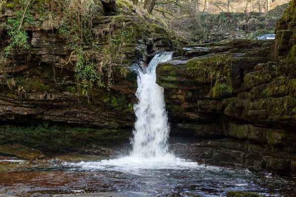
The best Bannau Brycheiniog hiking routes are not necessarily the ones with the highest summits. In South Wales, an adventure might mean following a broad ridge above a glacial valley, climbing a distinctive isolated hill, or descending into woodland to hear waterfalls before you see them. The variety makes the national park ideal for a weekend built around walking rather than a single summit photograph.
Choose your route by the adventure you want
Pen y Fan and Corn Du: a classic first mountain day
Pen y Fan reaches 886 metres, the highest summit in southern Britain. For an introduction to the central Beacons, the National Trust’s circular walk from Pont ar Daf takes in Pen y Fan and Corn Du. Its published route is about 6.4 kilometres and allows roughly three and a half hours. Well-built sections of path make navigation more straightforward in clear weather, although the climb and steps near the summits still demand effort.
This works when you want dramatic views without an all-day traverse. Expect company on popular weekends, carry an offline map and resist lingering at the summit if cloud or strong wind arrives. The exposed crest feels very different from the sheltered car park below.
The central Beacons horseshoe: a longer ridge challenge
Experienced walkers can consider the horseshoe from Taf Fechan in the Neuadd Valley. The National Trust describes a challenging 16-kilometre circuit taking approximately five to six hours, crossing high ground around Corn Du, Pen y Fan and Cribyn. The rewards include a continuous sense of space and impressive views into steep-sided valleys.
Difficulty comes from sustained climbing, distance and exposure rather than technical scrambling. Parts of the ridge can be boggy, while mist makes junctions less obvious. Allow extra time for food and slow sections, and check the entire route instead of assuming the return is a simple downhill stroll.
Sugar Loaf: an independent summit with wide horizons
Near Abergavenny, Sugar Loaf offers a different character from the central massif. Its rounded profile stands apart from neighbouring hills, so the summit panorama feels expansive. Approaches across grass and open hillside can be pleasantly direct in good conditions, but muddy ground and wind can slow progress. Choose a mapped ascent appropriate to your starting point, not an unverified online shortcut. It is a worthwhile contrast on a longer hiking South Wales trip.
The Skirrid: a shorter walk with a serious climb
The Skirrid, or Ysgyryd Fawr, rises near Abergavenny with a striking narrow ridge. The National Trust’s waymarked trail starts from the B4521 car park and covers about 6.4 kilometres in a suggested two hours. Woodland gives way to open ground, with sharp ascents and descents that make the walk energetic despite its modest distance. Watch your footing in wet weather and stay away from steep edges, especially in poor visibility.
Four Falls Trail: adventure below the ridgelines
Not all memorable bannau brycheiniog walks climb a summit. From Gwaun Hepste, the Four Falls Trail explores Waterfall Country on a roughly 8-kilometre circuit that Natural Resources Wales grades strenuous and estimates at three to four hours. The main route is generally broad and waymarked, but optional spurs towards individual waterfalls are steep, rocky and often slippery.
A group comfortable on the main woodland circuit might still struggle on the descent to a viewpoint. Wear footwear with reliable grip, allow time for the return climbs and keep children back from unguarded drops. The river pools are not safe places to assume swimming conditions are suitable.
Build a realistic day around terrain, not just mileage
Among brecon beacons walks, two routes of similar length can require different effort. A maintained uphill track may feel steadier than a shorter path through slippery gorge steps. Strong wind on a ridge can turn an otherwise straightforward outing into a tiring, cold experience.
Imagine a Saturday with an early start from Cardiff and a mixed-ability group. If everyone wants a mountain summit, Pen y Fan and Corn Du is a more sensible initial plan than the full horseshoe. If strong summit winds are forecast, consider a suitable lower-level walk instead. But do not automatically switch to waterfall gorges after heavy rain, when slips and river hazards can be greater.
Prepare for fast-changing South Wales conditions
Check the Met Office mountain forecast for Bannau Brycheiniog shortly before departure. Pay attention to summit wind, cloud, temperature and rainfall rather than only the forecast for the nearest town. Carry a paper map and compass and know how to use them; a charged phone with an offline route is backup, not your only navigation method.
Waterproof outer layers, spare warm clothing, food, water, a torch and appropriate footwear belong in your pack even on a promising morning. Let someone know your route and expected return time. On exposed ridges, keep clear of cliff edges and retreat if conditions or group energy deteriorate. For mountain walks in Wales, check temporary access closures, keep dogs controlled around livestock and take all litter home.
Make a weekend of Bannau Brycheiniog
For two days, choose contrasting landscapes rather than chasing the highest number of summits. A central Beacons ridge on the clearer day followed by Sugar Loaf or the Skirrid gives variety without repeating the same experience. Alternatively, pair one mountain day with Waterfall Country, provided conditions there are safe.
A South Wales weekend itinerary can help organise travel between trailheads, while a beginner’s mountain hiking checklist will help you prepare your kit. A guide to reading mountain weather forecasts is equally valuable when you need to change plans at short notice.
Frequently asked questions
What is the best Bannau Brycheiniog hiking route for a first visit?
The Pen y Fan and Corn Du circuit from Pont ar Daf is a popular starting point for reasonably fit walkers with suitable equipment. It provides memorable summit scenery on an established route, but it remains a mountain walk and should be avoided in conditions beyond your experience.
Are Bannau Brycheiniog routes suitable for beginners?
Some shorter, lower-level routes suit newcomers, while the horseshoe and other exposed ridge walks demand navigation skills and stamina. Match your route to the least experienced person in the group, not the fittest.
How long does the Pen y Fan walk take?
The National Trust’s Pen y Fan and Corn Du circular route is approximately 6.4 kilometres, with a suggested time of three and a half hours. Other starting points and variations change the distance and duration.
Can you walk in Bannau Brycheiniog all year?
Walking is possible year-round, but winter ice, snow, short daylight hours and severe wind can make high routes hazardous. Check current forecasts and ground conditions, and choose a lower-level alternative when the mountains are unsuitable.
A mountain trip worth planning properly
Bannau Brycheiniog hiking routes offer more than one iconic summit. Central ridges provide big mountain atmosphere, eastern hills bring different perspectives, and waterfall valleys deliver another kind of challenge. Pick the route that suits the forecast, available daylight and your group’s abilities. That is how an adventure becomes a day you will want to repeat.